Hi,
today we will present in CAA2012 in Southampton (GB) the result we obtain using Structure from Motion techniques with aerial images. The hardware we used are:
- KKMulticoper
- Nikon CoolPix S210
- Gopro HD Hero
The software are:
-ArcheOS
-Python Photogrammetry Toolbox
The picture below shows the three different phases of work (data acquisition, data processing and final result)
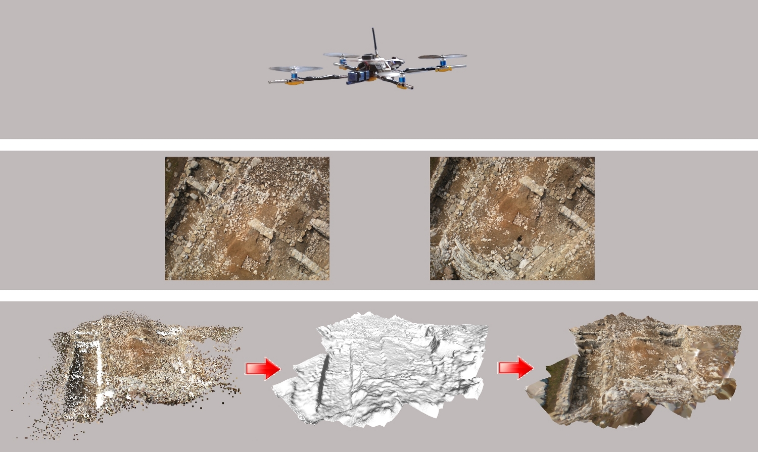
The two cameras made different results: the 3D model of the Nikon is more dense, but using the Gopro it is possible to have bigger terrain model.

In the next days we will upload the slides of the presentation.
Thank to Walter Morelli and Walter Gilli which help us in this research.
2016-03-31 Update
Thanks to self-archiving I can now add the bibliography related with this post:
ResearchGate: Article - Presentation
Academia: Article - Presentation
I hope it will be useful, even if no more up to date it can be a starting point to work in Aerial Archeology with Open Software and Hardware.

Did you perform the two flights at the same height? Which was the cause of the difference between the density of the model obtained with the Nikon and the GoPro?
ReplyDeleteHi Sara,
ReplyDeleteno, Walter Morelli, who helped us in this work, performed 5 flights to document four different areas. Three flights, with the assistance of Alessandro, using FPV (First Person View) techniques and two lower flights piloting normally. The two cameras were mounted together on the UAV, but we used the Nikon just for one single area, as it was to difficult to pilot and shut pictures at the same time. The Gopro was better in this because it can take pictures automatically. The difference between the two model is accidental, because in the other areas the Gopro gave us the same results than the Nikon, but we documented these areas just with the Gopro, so we had no comparative data. Something went wrong with the Gopro just in this case (probably some blurry photos)... anyway soon we will upload the presentation, in which it is possible to understand better this things.
Ok, Luca: thank you very much for your reply! You've been very clear and I'm looking forward to read your presentation!
ReplyDeleteMaybe the blurry photos result from GoPro lens plastic protection (some kind of dust or water accumulation, sun light reflex). Just guessing.
ReplyDeletergaidao
It can be...
Deleteanyway for next work we are planning to use a GoPro Hero 2 (it has some nice new stuff) and to implement the drone with a GPS, in order to record the path of the flight and test the autopilot option (as well as the "hold position" and "return home"). The components just came now by post. I will upload the presentation of the CAA as soon as possible, where there are also these details.
Ciao.