Showing posts with label emergency archeology. Show all posts

Friday, 18 April 2014

How to take pictures for photomosaics in narrow conditions: A clever solution for a common archaeological fieldwork problem.


Everyone who works on archaeological excavations knows situations like this:


A narrow and deep trench or a wall near to the limit of the excavation area.

If subsequently we have to make a photomosaic of the profile or facade, it means:

  • either photographing from the top, hazarding the consequences like distorsion:

  • or splitting the photomosaik in numerous single tiles, and that means a lot of work!


A very simple and clever solution for this problem can be the use of a mirror:

Putting it down in an inclined position on the ground and positioning yourself on the opposite side (watch the illustration beneath and heed me kneeing outside of the trench), it allows you to take a shot of the reflection of your facade in the mirror.
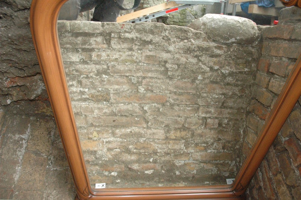
Of course the picture will show the object mirror-inverted, but don't worry:
The rectification software will fix it again...


Thanks a lot to Granma for borrowing us her wonderful kitsch bedroom-mirror!

Thursday, 15 August 2013

OpenJUMP: query to extract single points from a general vector layer

Hi all,
today I am working on data elaboration of an archaeological excavation. I decided to record a short videotutorial to show how to perform a very simple query in OpenJUMP (which is a topic I am often asked to explain during lessons about archeology and open source). Before to start, I'll write a short introduction regarding the processing of this data, just to understand why I need to perform this kind of query. 
I worked on this excavations collecting all the data in a local system (with simple 3D Cartesian coordinates), because the job was an emergency archeology project and I did not have the time to set up a geographic coordinate system on the field, before the construction site began. Just at the and of the excavation, I could come with a RTK GPS, to collect some Ground Control Points (GCP) in UTM WGS84. This is the reason why in this time, when I am processing the data, I had to put together all the daily total station downloads in a single cvs file, which I georeferenced in OpenJUMP, using the GCP I collected with the GPS. The problem is that now I will have to separate again the single points, grouping them according to their function (e.g. points for photomapping of area 1, height points of the same area, points for SfM georeferencing, find-points and so on...). To do this operation, I will simply use OpenJUMp (where I loaded and georeferenced the csv file), performing a query on the attribute (the name) of cumulative vector layer , which will tell me where are the the points I need. In this way I can select in the GIS the features I am looking for and put them in a new vector level, copying the db schema of the cumulative layer (name, y, x, z, code). At the end of the process, I will have single separated vector files which I will use in the next steps of data processing (photomapping, 3D, ecc...).

Here is the videotutorial I uploaded in the ArcheOS tutorila wiki (rom Insbruck University):


I hope it was useful, have a nice day!
BlogItalia - La directory italiana dei blog Creative Commons License
This work is licensed under a Creative Commons Attribution 4.0 International License.